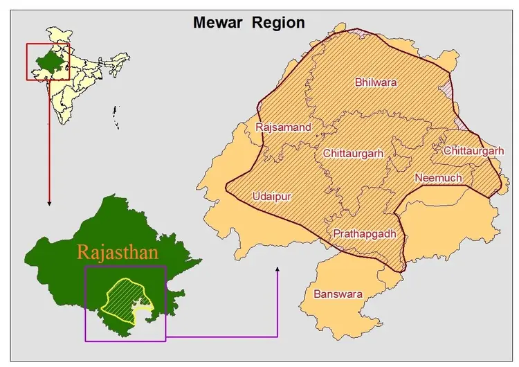
The Mewar region comprises of the four southern districts of Rajasthan, India, namely, Udaipur, Chittorgarh, Rajsamand and Bhilwara. The Mewar area is between 74° and 75.5° east longitude and between 24° and 26° north latitude. Mewar consists of both plains and hilly areas. This entire region is separated from the Thar Desert of Rajasthan by the Aravalli mountain range.
The region has to depend upon the rains for its agricultural needs. The people mainly cultivate wheat, maize, mustard, lentils, etc. Cultivation is heavily dependent on rain and natural water resources. Water scarcity is a major challenge for cultivation in this region.
On the whole, the region has a dry climate. Winter lasts from December to February and is followed by summer, which lasts until about the middle of June. Mid-June to mid-December constitutes the South-western monsoon season. The post-monsoon period, from mid-September to the end of November, is the time of transition from monsoon to winter conditions.